Patocco on Google Maps
Patocco Location
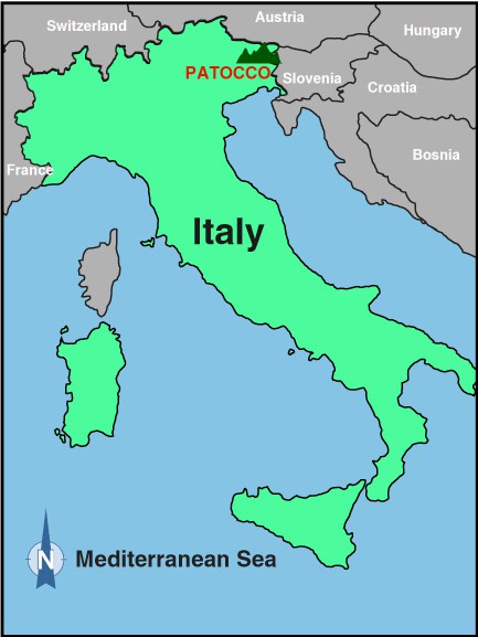
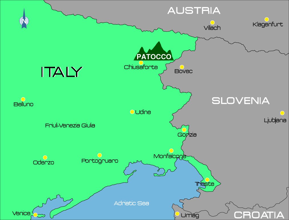
Pattoco is located in the North East of Italy in The Julian Alps close to the borders with Austria and Slovenia.
Patocco
Frazione di Chiusaforte
33010
Udine
Italy
Geo: N 46.406369 , E 13.351607
The village of Patocco can be reached by road from Chiusaforte and the SS13.
Directions from Chiusaforte
- From the ss13 “Pontebbana” at Chiusaforte, turn South East onto the bridge across the River Fella onto the sp76 road for the Val Raccolana and Sella Nevea.
- Follow this road for 2.5km into the Val Raccolana then take the left hand branch off the main road (sp76) signposted to Patocco and Chiout Michel.
- This road climbs up through two hair pin bends followed by a level section with four tunnels.
- After 2.5km the tarmac finishes, at this point there is a very sharp left turning and the road narrows to a single track and climbs up through a series of hairpin bends to reach Chiout Michel.
- Drive through Chiout Michel and the road continues to climb through more hairpin bends until you reach Patocco after 6.8km where you will find the main parking area below the church.
Alternative routes
Patocco can also be reached on the SP76 in the opposite direction via Sella Nevea, from Tarvisio or Passo Predil. It is about a 15km distance from Sella Nevea to the junction for Patocco/Chiout Michel. In this case, the junction effectively requires a U-turn which means maneuvering on a bend which should be done with great caution!
For those who like walking, Patocco can be reached on the CAI (Club Alpino Italiano) footpath 620, which starts from behind the Church in the Frazione of Raccolana, Chiusaforte and climbs gently up Rio Patoc for approx 5km. The path has a lot of tree cover and meanders alongside the river with many waterfalls and pools making for an enchanting passage. It will take an hour plus to arrive in Patocco.
Chiusaforte to Patocco in under two minutes
The slideshow below shows you the route described above in a series of pictures courtesy of Google Street View.